Earth observation is a game-changer for climate resilience
Iceye is building a ‘powerful back catalogue of analysis’ that will improve insurers’ ability to understand and manage the impact of climate change, Stephen Lathrope and Rupert Bidwell say

Executives at Finnish microsatellite maker Iceye outline how fast and reliable natural catastrophe data before, during and after events creates a ‘sweet spot’ of resilience
Earth observation has the potential to transform the way re/insurers model and respond operationally to natural catastrophe perils, according to Stephen Lathrope and Rupert Bidwell, respectively senior vice-president of solutions and global head of insurance at Iceye.
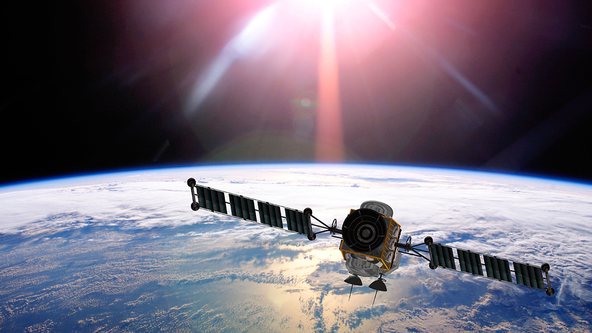
The Finnish microsatellite manufacturer and operator owns the world’s biggest privately owned synthetic aperture radar (SAR) satellite constellation that detects and responds to changes in any location on Earth. Its objective and near real-time insights are gathered day and night, and even in low-visibility conditions.
In an interview with Insurance Day, Lathrope and Bidwell explain how such insights empower re/insurers and other organisations in adaptation and resilience to climate change.
They highlight Iceye's collaboration since 2020 with Tokio Marine to develop new insurance products and services.
“Tokio Marine is able to use our data to manage claims more effectively,” Bidwell says. “Combining Iceye data and their customer-supplied data helps to reduce the need for onsite adjusters. That’s a game-changer.”
Lathrope says that Iceye data can be “dropped into” existing systems and encourages re/insurers to “experiment” with SAR data. “Tokio Marine started that way three years ago and is now making really important business decisions using our data.”
Other projects that Iceye has been involved in with its public and private partners include: providing flood and bushfire data for the Australian government to strengthen disaster response; working with Guy Carpenter and Swiss Re on a parametric pilot programme to protect low-income communities in New York City from flooding; and supporting a United Nations Development Programme (UNDP) and Insurance Development Forum (IDF) initiative to increase flood resilience in Ghana and Nigeria.
Iceye recently announced a new contract with the Centers for Disease Control and Prevention (CDC), which provides the federal agency with access to Iceye flood insights for events across the US and its territories. As part of the agreement, Iceye will deliver flood impact data and analysis to teams at CDC’s Geospatial Research, Analysis, and Services Program.
Iceye's reach extends to ecological disasters that are not weather-related, such as the breach of the Kakhovka Dam in Ukraine in June 2023, and also to defence, which includes its August 2022 contract with the Serhiy Prytula Charity Foundation that allows the Ukrainian armed forces to receive its radar satellite imagery on critical locations with a high revisit frequency.
Synthetic aperture radar technology
SAR technology overcomes the size-versus-resolution issue presented by real aperture radar (RAR), which is limited by the size of the antenna that can be sent into space. To produce high resolution imaging of the Earth’s surface, the antenna of a RAR needs to be hundreds of times greater in size than a satellite can carry. A SAR, on the other hand, uses movement of its antenna to “synthesise” a larger aperture that collects signals from brief, closely spaced successive pulses.
Lathrope says that, although satellite technology has existed for more than 70 years, there has been a “quiet revolution” in the past 15. For example, the number of spacecraft launches increased from 53 in 2017 to 1,743 in 2021. A major purpose of such launches is to place satellites into orbit, which now number close to 10,000. Key enabling factors behind that number are the miniaturisation of technologies, lighter materials and lower launch costs.
“There's a huge range of satellite-borne sensors in orbit and they can be used to observe weather systems,” Lathrope says, “by measuring temperatures, CO2 levels in the atmosphere and moisture in soil, as well as ice formations, forestation and a whole host of other things that are either understood to be factors that influence climate change or are indicators climate change is happening.”
SAR technology is evolving all the time to provide better resolution, volume and timeliness of information. One of the “real differentiators” that Iceye brings, Lathrope says, is that it has launched more than 35 SAR satellites into orbit – a figure he believes is substantially more than other operators. Uniquely, he adds, Iceye has a strong focus on natural catastrophe reporting, particularly for insurers and for governments.
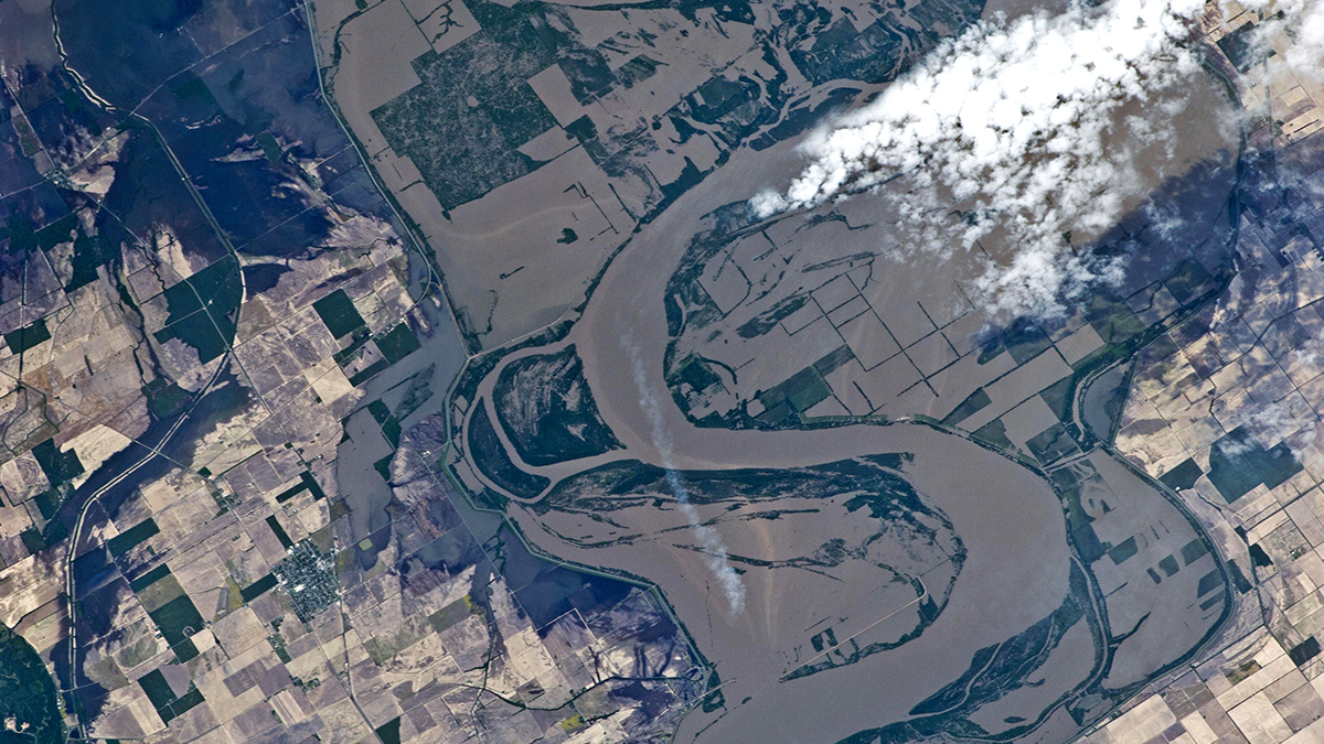
SAR technology is well suited to the observation of natural catastrophe events, Lathrope explains, because it sends its own signal, and then receives the signal that bounces back from whatever it encounters on the Earth's surface.
“That's important because it doesn't rely on light from the sun like optical imagery does. As a result, it can monitor the Earth day and night. The particular wavelength that we use, moreover, also enables us to see through clouds, smoke and dust, which means radar eyes on the ground, whatever the conditions.”
For example, Iceye demonstrated the flexibility of its technology for recent volcanic activity in Iceland. “In collaboration with the Icelandic Met Office, we did some work monitoring that seismic activity. And we were able to see deformation of the land around that event by six or seven centimetres over a nine-day period. So, we can measure quite specific, quite detailed, and quite small movements on the ground using that technology,” Lathrope says.
Within its SAR constellation, Iceye can electronically move the antenna, either to zoom out to scan hundreds of square kilometres of an area, such as to monitor hurricanes making landfall, or zoom in to measuring millimetres of change, such as the thermal expansion of buildings. Lathrope describes balancing these actions as a “trade-off” between levels of resolution.
Iceye takes multiple images as one satellite passes over a given area and this enables it to observe movement – of direction and of speed. It can also make three dimensional images of structures by looking at them from different sides as a SAR satellite passes overhead. Each satellite completes a lap of the Earth every one-and-a-half hours.
“We don't speed them up or slow them down as they're passing but we do have the ability to adjust their orbits slightly, to direct radar imaging at different angles,” Lathrope says.
Climate change impacts
Iceye is at the “sharp end” of the management of climate risk, Lathrope stresses. “We’re focused on enabling our customers to help communities, businesses and their insured customers deal with the impacts of climate change. Their resilience and response to individual events is a core focus for Iceye,” he says.
“We're building a really powerful back catalogue of analyses of events, which are going to be very useful to a number of organisations in understanding what the impact of climate change is over time,” he adds.
Iceye uses its technology and data analytics to provide near-term predictions of events and then report on how they are evolving. “We're at the sharp end of the change, rather than reporting on the big trends that represent climate change overall,” Lathrope says.
Being able to provide data over time is “powerful” in helping re/insurers refine their catastrophe models, but Lathrope is clear about the boundary between Iceye and the catastrophe modellers.
 Stephen Lathrope, senior vice-president of solutions, Iceye
Iceye
Stephen Lathrope, senior vice-president of solutions, Iceye
Iceye
“Even having completed 200 flood analyses and delivered those to our customers around the world, over the last three years or so, we don't second guess the modelling companies,” he says. “What we can do is help with resilience in response to an event, based on an understanding at a much higher resolution of what has happened on the ground.”
Iceye analysis supports the development of parametric insurance solutions to help close the protection gap, Lathrope says. Citing an estimate by Swiss Re in 2021, that 80% of economic losses from flooding was uninsured, he highlights IDF and UNDP projects in Nigeria and Ghana that Iceye supports.
“We’re focused on enabling our customers to help communities, businesses and their insured customers deal with the impacts of climate change. Their resilience and response to individual events is a core focus for Iceye”
Stephen Lathrope
Iceye
Bidwell stresses how SAR satellites also serve climate risk analysis by capturing extreme weather events where and when they are not normally expected to occur, such as the recent flooding in Dubai last month and the Marshall Fire in Colorado in December 2021. “The characteristics, frequency and severity have significantly changed just in the last two or three years, and we can see that from our data,” he adds.
The ability of re/insurers to respond rapidly to catastrophe events is thus more important than ever. “The secondary perils, which we focus on, are now becoming as expensive as primary perils,” Bidwell notes. “A hurricane is a peak event but a big element of it will be large-scale flood damage.”
A series of named storms and consequent flooding in the UK was unexpected, given that, before 2021, in terms of insured losses, “it was actually relatively quiet”, Bidwell says. “From an insurance perspective, named storms are operationally very stretching because there's a huge volume of claims, many quite small but alongside some large claims. This creates a huge operational stress for most insurers, particularly if the named storms come in quick succession,” he adds.
Iceye recently announced the launch of its high-resolution Flood Early Warning and ongoing customer pilots of Flood Rapid Impact solutions for the UK insurance market.
The Flood Early Warning provides four days in advance flood impact forecast prediction. This is at building-level resolution and is overlaid with the respective UK environment agencies' flood hazard zones. Iceye’s Flood Rapid Impact is a rapid satellite data-derived flood extent map, delivered within 12 hours of the start of the flood and at eight to 12-hour intervals thereafter, enabling insurers to track the progression of the flooding.
Three main goals
Iceye supports approximately 30 insurers, brokers and reinsurers across the globe at present, and Bidwell outlines the team’s three main goals.
The first is to provide critical natural catastrophe data insight, “as fast and as reliably as possible”, before, during and after events. That means insurers can “transform” their claims processes, he says, “and don't need to wait for customers to notify them before taking action”.
 Rupert Bidwell, global head of insurance, Iceye
Iceye
Rupert Bidwell, global head of insurance, Iceye
Iceye
The second is for insurers to “proactively intervene” by protecting their insureds from a flood or wildfire ahead of an event itself. “It is so much better to protect the customer than having to restore a customer,” he says.
The third goal is for Iceye to build an historic catalogue, which Bidwell says will help refine risk engineering interventions.
Iceye provides flood early warning data for about 15,000 locations. One of its clients for this product is Nordic insurer, If. “We’re able to alert individual client managers to when there is a flood potentially about to impact one of their insured’s locations,” Bidwell says.
“The secondary perils, which we focus on, are now becoming as expensive as primary perils. A hurricane is a peak event but a big element of it will be large-scale flood damage”
Rupert Bidwell
Iceye
Iceye's leading client in Australia is Suncorp group, which has invested in a 24-by-7 event control centre to manage their catastrophe event response. “This is a control room with a number of screens where they are monitoring all manner of different weather phenomena occurring across Australia, and our data is used to inform their critical decisions around flood and wildfire, before, during and after the actual event,” Bidwell says.
Bidwell’s advice to re/insurers is “not to be held back” by any preconceptions about satellites. “Historically, a lot of insurers have experience of aerial drones and optical satellites and they found they missed a flood or a fire, but visibility isn't a constraint using synthetic aperture radar satellites because they can see through clouds and through the dark,” he says.
Data gleaned from SAR satellites offers “real value for relatively limited effort”, he stresses. “You don't need huge IT investment or to start off with IT integrations but, as and when you do want to make your use of the data more industrial, it can be embedded in policy admin claims systems and geospatial exposure management platforms, through APIs. To start with though, you can be tactical and get value very quickly.”